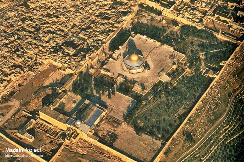
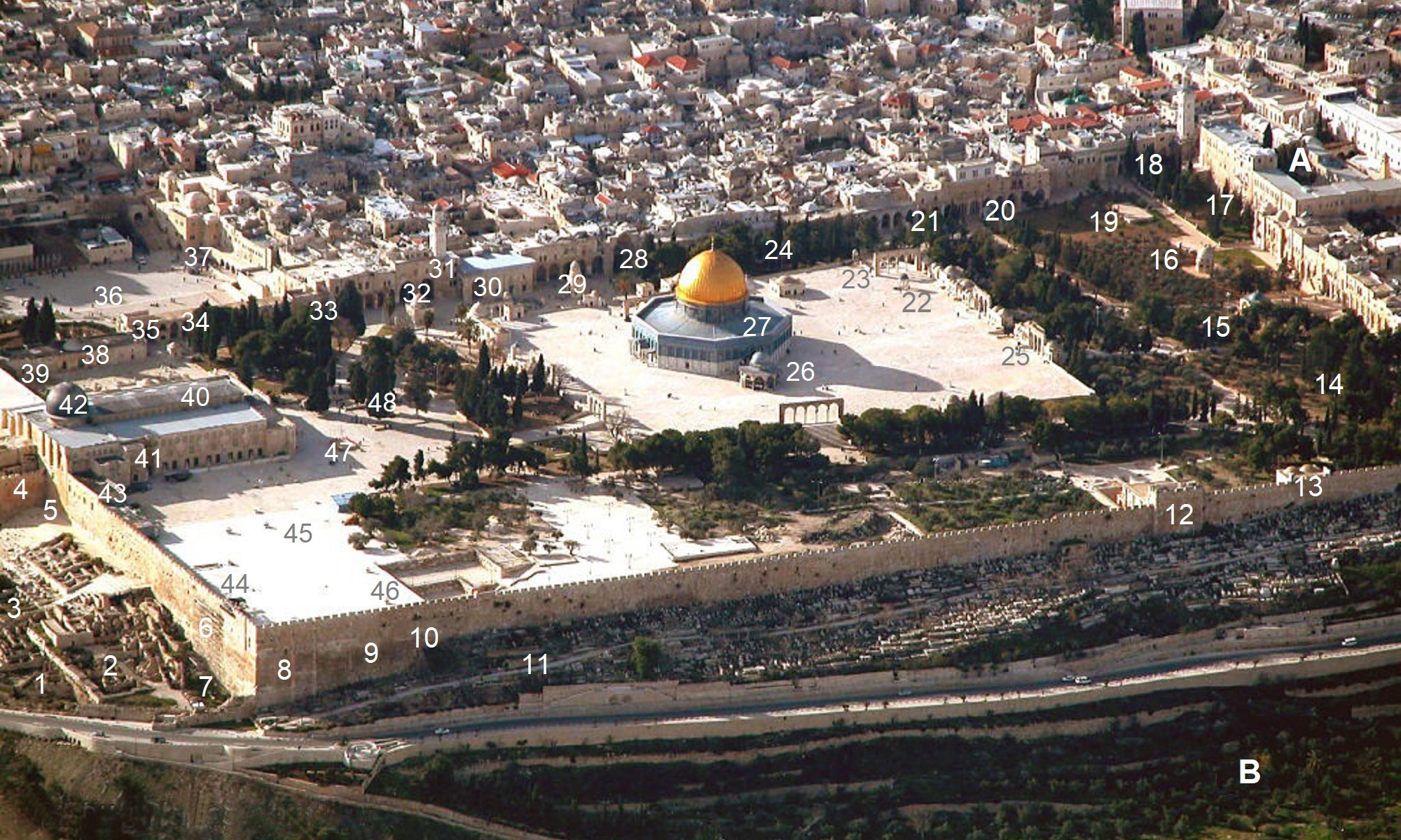
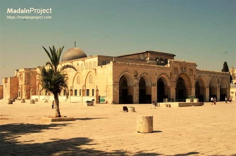
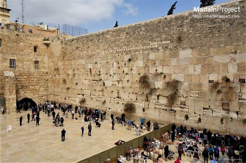
The following is an interactive map of the Temple Mount, a digital visualization designed to present the architectural, topographical, and historical features of one of Jerusalem’s most significant religious sites. The map provides a spatial representation of the Temple Mount—also known as Ḥaram al-Sharīf—highlighting major structures such as the Dome of the Rock, the al-Aqṣā Mosque, the Western Wall, and the surrounding architectural and archaeological elements. By allowing users to explore the site through an interactive interface, the map facilitates a comprehensive understanding of the Temple Mount’s physical layout, historical development, and enduring religious importance.
This interactive map situates the Temple Mount, one of the most important landmarks in the Old City, within its broader historical and cultural context, illustrating its evolution from the First and Second Temple periods to its present form as a focal point of Islamic worship and a site of global heritage significance. The platform integrates cartographic data, historical documentation, and modern imaging technologies to offer a multidimensional perspective on the site’s complex history.
Through this combination of historical accuracy and digital interactivity, the map serves as both an educational and analytical resource, supporting scholarly inquiry and public engagement with one of the most historically and spiritually resonant locations in the world.


Signup for our monthly newsletter / online magazine.
No spam, we promise.
The Madain Project is an online archive of Abrahamic History and Archaeology.
Abrahamic History & Archaeology is the study of history and archaeology with respect to the three Abrahamic Faiths without considering the religious and theological aspects. The goal of Abrahamic History is to understand how and why the religious doctrines and behaviours have evlovled and changed over time. Searching for patterns in the evolution of significant cultural events such as the development of farming, the emergence of cities, or the collapse of major civilizations for clues of why and how these have influenced the three major Abrahamic religions.
Cloud Drive -
About -
Help -
Editorial Policy -
AI Policy -
Privacy Policy -
Contact
Madain Project: Encyclopedia of Abrahamic History & Archaeology.
Copyright MadainProject 2017 - 2026.
![]()
![]()
![]()
![]()
![]()
![]()