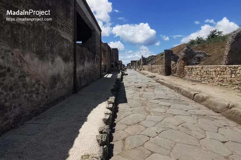
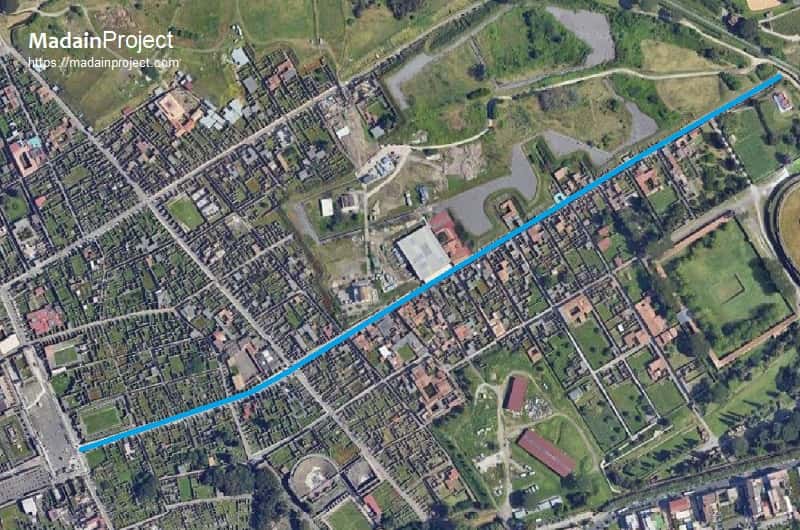
The so-called Via dell’Abbondanza, literally meaning the "street of abundance", is the principal east-west street (decumanus maximus) in the ancient Roman city of Pompeii, measuring approximately 900 meters in length and functioning as one of the main commercial, civic, and residential axes of the city. The designation Via dell’Abbondanza is a modern name, in ancient times however it was simply known as the decumanus.
The modern name is derived from a fresco in the House of the Centenary depicting the personification of "Abundantia". Another tradition suggests that the name "Via dell'Abbondanza", meaning "Street of Abundance", originates from the the large amount of artefacts discovered on and along the street. It may also refer to the lively and bustling nature of the street during Roman times.
The street was laid out during the Samnite phase of Pompeii’s urban development in the 2nd century BCE and was extensively adapted during the Roman Imperial period, particularly after the 62 CE earthquake. By the time of the city's destruction in 79 CE, Via dell’Abbondanza served as a critical artery connecting the city’s Forum in the west to Porta di Sarno in the east. It provided access to shops, public buildings, religious structures, elite domus, and working-class housing. It is also one of the best-preserved and most extensively excavated thoroughfares in Pompeii.
Via dell’Abbondanza was a major commercial zone, populated with shops selling bread, wine, oil, and prepared food. Many tabernae display built-in counters and storage amphorae. Painted electoral slogans (programmata) preserved on walls indicate political campaigning, often sponsored by shopkeepers or property owners. Several workshops (officinae) have been identified, including those for fullers, metalworkers, and possibly glassmakers.
The street was initially excavated in the 19th century, with systematic work continuing into the 20th and 21st centuries. Extensive digital documentation has been conducted through the Pompeii Forum Project and the Via dell’Abbondanza Project by the University of Bologna and others. Preservation efforts include conservation of wall paintings, graffiti, and architectural stabilization. The eastern portion near Porta Sarno remains less extensively excavated but is the focus of recent archaeological attention.

Via dell’Abbondanza runs from the Forum at its western end to Porta di Sarno at its eastern terminus. It passes through Regions VII, VIII, and I, with major intersections at Via Stabiana (north-south axis) and Via di Nocera. It divides several insulae, notably Insula I.6, I.7, VIII.4, and VII.9, and serves as the organizing axis for a dense network of civic, religious, and commercial activities.
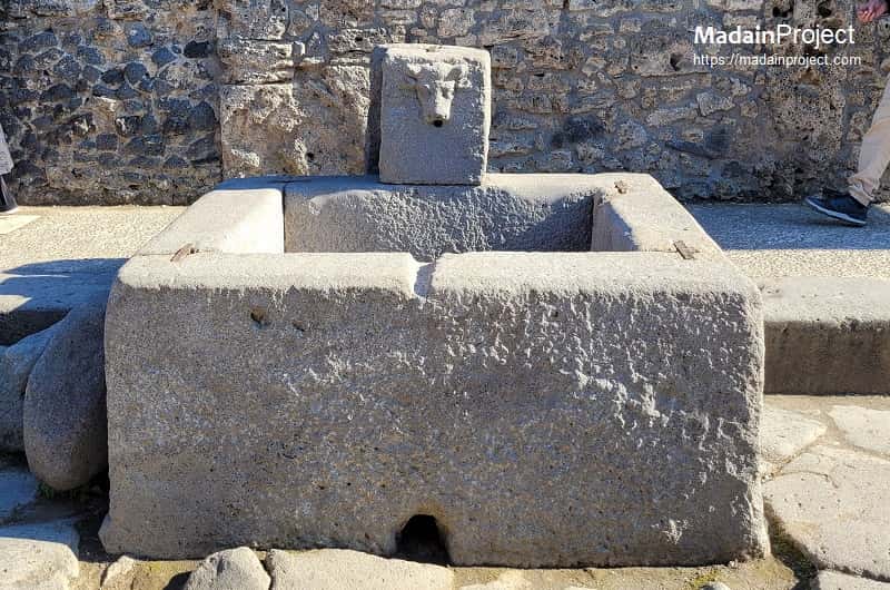
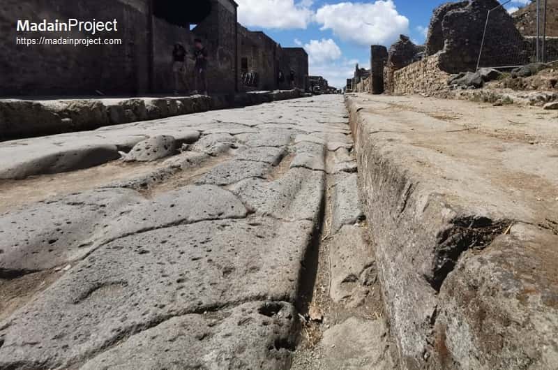
Via dell’Abbondanza was constructed using polygonal basalt paving stones, with raised pedestrian sidewalks (crepidines) on both sides. Stepping stones were strategically placed to allow crossing during water runoff without impeding cart traffic. Wheel ruts from wagons are still visible, indicating heavy use. The street was approximately 4.5 to 5 meters wide and had a camber for drainage. Evidence from excavations suggests that the street included embedded infrastructure such as lead water pipes (fistulae) and connections to public fountains. Numerous shops (tabernae) opened directly onto the street, often with upper-floor housing or rental units (cenacula).
Forum Access and Civic Buildings
At its western terminus, Via dell’Abbondanza opens directly onto the Forum, the civic heart of Pompeii. Immediately adjacent, to the south, are the Comitium, and administrative structures. This proximity emphasizes the street’s role as a transition space between the ceremonial-political core and the commercial-residential body of the city.
Eumachia Building
Situated on the northern side near the Forum, the Building of Eumachia is a large Augustan-era structure with a columned courtyard, rear apse, and brickwork inscription linking it to the fullers’ guild. It runs approx. 67 meters along the north flank of the street. Financed by Eumachia, a public priestess, it functioned as both a civic and commercial facility.
Domus and Workshops
East of Via Stabiana, the urban fabric becomes mixed-use, combining elite houses with attached commercial zones. The house of the Cryptoporticus includes refined wall paintings and a subterranean corridor, while the House of Loreius Tiburtinus features a canal-lined viridarium. The house or estate of Julia Felix, house of the Lararium of Achilles, and house of Vetutius Placidus along with other residential complex demonstrate how domestic and commercial life intertwined along the street. Also the house of Julia Felix is also accessible from the street. Other notable residential structures situated along the Via dell’Abbondanza include House of Venus in the Shell, House of the Moralist, House of the Orchard, House of Julius Polybius, House of the Indian Statuette, House of the Priest Amandus, and House of Fabius Amandus etc.
Stabian Baths
Situated just west of the intersection of the Via dell’Abbondanza and the Via Stabiana, the Stabian Baths (Thermae Stabianae) represent one of the oldest and most architecturally significant public bathing complexes in Pompeii, with origins dating back to the 2nd century BCE. Though their primary entrance fronts the Via Stabiana, their northwestern façade directly abuts the Via dell’Abbondanza, making them a prominent landmark along the eastern segment of the street. The complex was extensively remodeled in the 1st century BCE and again in the early imperial period, incorporating separate facilities for men and women, advanced hypocaust heating systems, and a palaestra for exercise. The proximity of the baths to the forum and commercial activity on Via dell’Abbondanza underscores their role not only in hygiene and leisure but also as a social node in the daily lives of Pompeians traversing this major urban artery. Architectural features visible from Via dell’Abbondanza, including ashlar masonry and decorative pilasters, marked a visual transition from civic-commercial spaces toward more recreational public zones.
Shops and Thermopolia
Proceeding eastward into Region VIII, the street becomes lined with commercial units—tabernae, bakeries, and thermopolia. The thermopolium of Vetutius Placidus retains its service counter with embedded dolia and painted offerings. These businesses catered to pedestrians and cart traffic moving between the Forum and Via Stabiana.
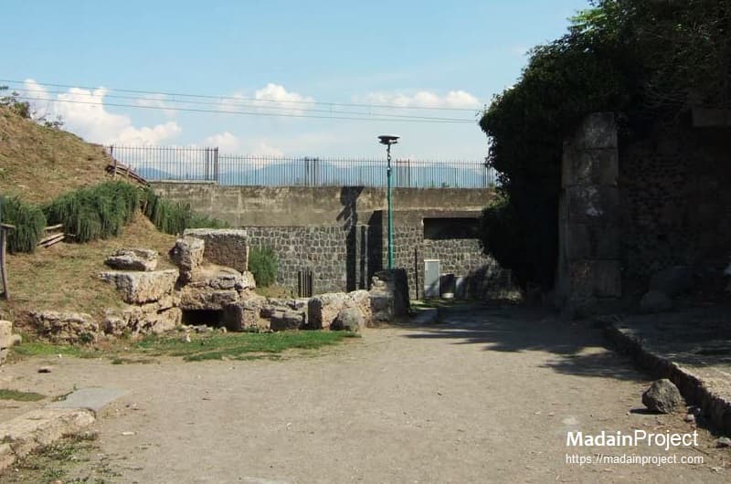
Porta Sarno
The Sarno gate, the eastern gate of Pompeii, served as the formal terminus of the Via dell’Abbondanza, anchoring the street’s axial trajectory from the forum to the city’s edge. Though less monumental in appearance than gates like Porta Marina, Porta Sarno was strategically significant, opening onto the Sarno River plain and associated extramural infrastructure, including tombs and access roads to Nuceria and the Sarno harbor. Archaeological evidence indicates that the easternmost stretch of the Via dell’Abbondanza narrowed as it approached the gate, transitioning from the densely built urban fabric of Region I into a more liminal civic-mortuary zone. Tombs clustered outside the gate, such as the richly decorated tomb of Eumachia, reflect both elite patronage and the symbolic continuation of the street’s function as a social conduit—linking daily urban movement with funerary commemoration. Thus, Porta Sarno was not merely a point of exit but an architectural and ritual boundary that framed the Via dell’Abbondanza as both a thoroughfare and a processional route.
Signup for our monthly newsletter / online magazine.
No spam, we promise.
The Madain Project is an online archive of Abrahamic History and Archaeology.
Abrahamic History & Archaeology is the study of history and archaeology with respect to the three Abrahamic Faiths without considering the religious and theological aspects. The goal of Abrahamic History is to understand how and why the religious doctrines and behaviours have evlovled and changed over time. Searching for patterns in the evolution of significant cultural events such as the development of farming, the emergence of cities, or the collapse of major civilizations for clues of why and how these have influenced the three major Abrahamic religions.
Cloud Drive -
About -
Help -
Editorial Policy -
AI Policy -
Privacy Policy -
Contact
Madain Project: Encyclopedia of Abrahamic History & Archaeology.
Copyright MadainProject 2017 - 2026.
![]()
![]()
![]()
![]()
![]()
![]()