The Girsu Bridge is an ancient brick structure spanning an internal, now dried up, canal at the Sumerian city of Ĝirsu (modern Telloh, Dhi Qar Governorate, present day Iraq). It is widely regarded as the earliest known bridge in the archaeological record, dating to the Early Dynastic period of Mesopotamia (circa late 3rd millennium BCE). Its function combined both hydraulic control and pedestrian crossing, enabling movement across a major canal axis within the urban core and providing access to sacred precincts.
The bridge, discovered in 1929 CE, is situated on a major palaeo‑canal (commonly referred to in the literature as canal 3 at Girsu), part of the city's engineered waterways that linked Girsu with surrounding settlements and irrigation networks. Textual and stratigraphic evidence suggests it was constructed in the Early Dynastic I–III phases (circa 2900–2600 BCE) and remained in use through subsequent periods, including the Late Akkadian, Ur III and Isin‑Larsa periods (circa 2200–1800 BCE).
The structure had a complex interpretive history in scholarship: early excavators (De Genouillac and Parrot) variously interpreted it as a water regulator, shrine, or pseudo‑tomb, reflecting uncertainty about its form and function. Later research, supported by remote sensing, stratigraphic data, and renewed fieldwork, has confirmed its identification as a bridge‑cum‑hydraulic feature crossing a canal channel.
Inscriptions on foundation bricks, dedications to the god Ningirsu, and references to Ur‑Ningirsu (the successor of Gudea) further indicate its ritual and civic significance in the urban landscape, linking civic infrastructure with Sumerian sacred kingship and cultic access.
It is considered to be the oldest standing bridge in the world.
circa 2900–2600 BCE
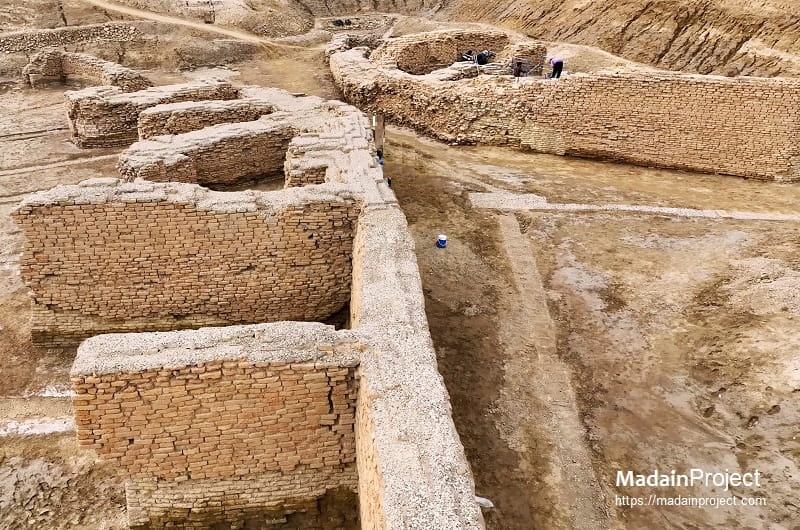
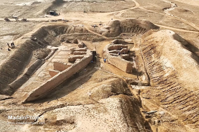
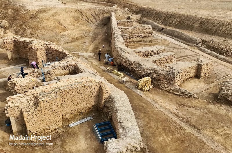
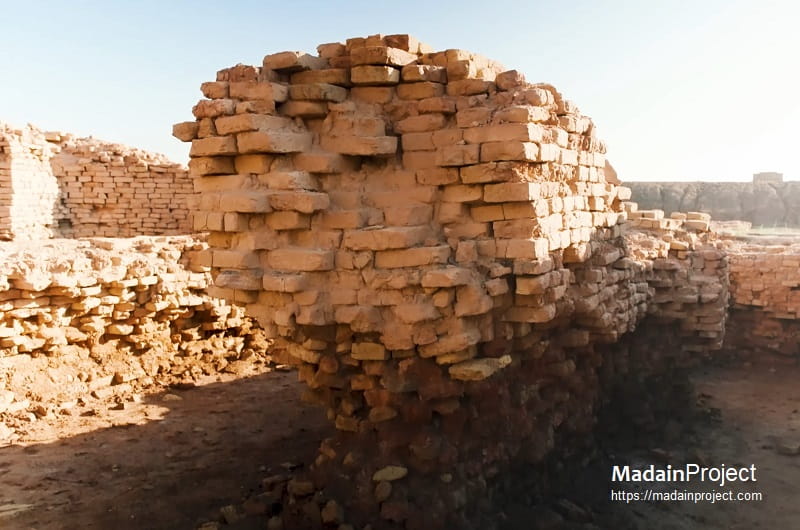
Architecturally, the Girsu Bridge was built using baked and mud bricks—standard Sumerian construction materials—with surfaces coated, where preserved, in bitumen for water resistance. Geophysical studies and excavations indicate that the structure functioned as a constricted passageway along a canal originally up to ~30 meters wide, narrowing to as little as ~4 meters at the bridging location.
The built feature measured roughly 40 meters in length and over 10 meters in width, with substantial lateral retaining walls (reaching to a height of approx. 11 feet) that may have helped channel water flow beneath or adjacent to the crossing. The design of the walls was pinched in the middle to reduce the width of the ancient canal so that it could be spanned by timber planks. Its design appears to have introduced a controlled hydraulic constriction—akin in effect to what engineers later define as a throated flume—facilitating both effective water management and stable crossing infrastructure.
Internal stratigraphy reveals that underlying Ubaid-level deposits were cut during the construction of the canal and bridge, demonstrating that these hydraulic features post‑date early occupation phases at Girsu. The survival of contexts associated with canal fill and structural bases has enabled radiocarbon correlation with cultural materials from late 3rd‑millennium contexts.
circa 2900–2600 BCE
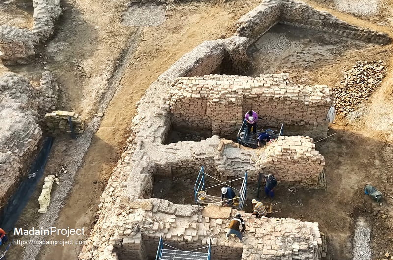
The Girsu Bridge has been a central focus of heritage conservation through the Girsu Project, led by the British Museum in collaboration with the Iraqi State Board of Antiquities and Heritage. This multi‑year endeavour addresses long‑standing issues of stability, erosion, and documentation that followed nearly a century of exposure and earlier excavation without conservation protocols.
Since 2017–2018 CE, field seasons have included targeted interventions at the bridge area to assess structural condition, stabilise exposed masonry, and integrate the monument within broader site management plans. These efforts form part of wider training and capacity‑building programmes for Iraqi archaeologists and conservators, aimed at developing in‑country expertise in monument conservation.
Conservation methodology has involved detailed recording of extant structural elements, stratigraphic assessment of canal deposits adjacent to the bridge, and consolidation of brickwork to mitigate ongoing deterioration. The Girsu Project also places emphasis on digital documentation (including photogrammetry and 3D modelling) to ensure that the bridge’s current condition and interpretive reconstructions are preserved for research and heritage interpretation.
The ongoing work not only secures one of the world’s earliest known engineered structures but also leverages it as an educational and cultural resource—forming a focal point for site interpretation, future tourism planning, and scholarly dissemination in Iraq and internationally.
Signup for our monthly newsletter / online magazine.
No spam, we promise.
The Madain Project is an online archive of Abrahamic History and Archaeology.
Abrahamic History & Archaeology is the study of history and archaeology with respect to the three Abrahamic Faiths without considering the religious and theological aspects. The goal of Abrahamic History is to understand how and why the religious doctrines and behaviours have evlovled and changed over time. Searching for patterns in the evolution of significant cultural events such as the development of farming, the emergence of cities, or the collapse of major civilizations for clues of why and how these have influenced the three major Abrahamic religions.
Cloud Drive -
About -
Help -
Editorial Policy -
AI Policy -
Privacy Policy -
Contact
Madain Project: Encyclopedia of Abrahamic History & Archaeology.
Copyright MadainProject 2017 - 2026.
![]()
![]()
![]()
![]()
![]()
![]()