Herodian Street is a corridor along the Western Wall of the Temple Mount (Haram al-Sharif). The street was uncovered for a total length of 70 meters It is about 10-12 meters wide, paved with large (3x1.5 meters), very thick stones, carefully trimmed and joined together for comfortable walking. Current length of the excavated street starts from the south-east corner of the Temple Mount, where a number of commercial structures have been exposed.
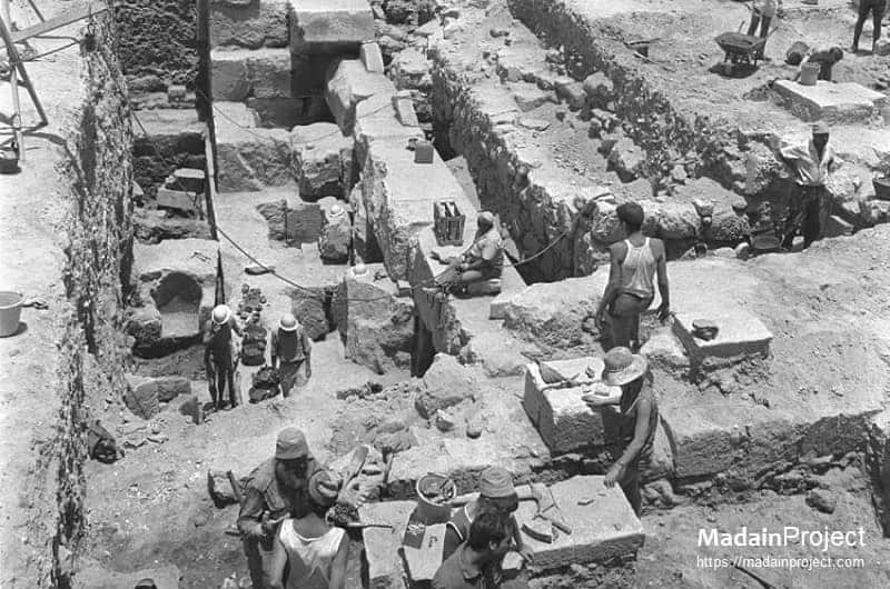
General view of the Herodian Street along the Western Wall of Temple Mount (Haram al-Sharif). From 1993 to 1997, new excavations were conducted between the Western Wall and the southwestern corner of the Temple Mount.
After removing the debris of later periods, the Herodian street running along the western wall of the Temple Mount was exposed in its full length. The shops as seen on the left were probably on both sides of the road and this area whould have been a very busy commercial site (illustration). Pile of stones in the background is from Roman destruction of the Temple from 70 CE.

circa 10 CE

Aerial View of the Herodian Street (identify) at the Haram al-Sharif (Temple Mount). It follows the course of the Tyropoeon Valley between the Temple Mount and the western hill, where the Upper City, the quarter of the well-to-do in the Herodian period, was located (today's Jewish and Armenian quarters within the Old City wall and Mt. Zion south of the wall).
circa 10 CE

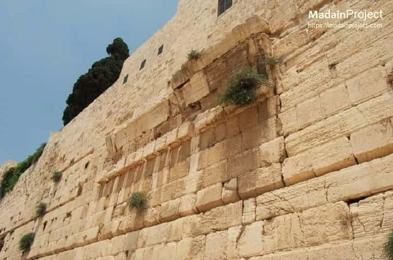
Herodian Shops
The Herodian Shops was a cluster of cells built along the Western wall on the southwest corner. Between the street and the western wall of the Temple Mount, a row of small shops which opened onto the street was found. The cluster of shops included some 3 or 4 shops along the western wall and 5 or 6 shops on the opposite side of the street. Evidence of the commerce that once took place here is provided by the many stone weights of different sizes which were found in this area.
circa 10 CE

Roman Era Bakery
The Roman (or possibly earlier Herodian) era bakery (identify), the structure in the middle of the picture was identified as a bakery due to the circular floor ovens were found there. It was a military bakery, which operated near the southeastern corner of the Temple Mount enclosure between the second half of the second century and the late third century CE. In this structure, three large and two small ovens, with a floor made up of stamped roof tiles, were discovered
circa 10 CE
Robinson's Arch
Remains of Robinson's Arch, an unusually wide stone arch (illustration) of a monumental staircase, which once stood at the southwestern corner of the Temple Mount. The base of this massive arch protrudes from the western wall, some 12 meters north of the southwestern corner of the Temple Mount enclosure. It was built as part of the expansion of the Second Temple initiated by Herod the Great at the end of the 1st century BCE.
circa 10 CE

Trumpting Stone Replica
A replica of the Trumpting Stone at the site where the original was found. The original is now in the Israel Museum. It is believed to be a directional sign (illustration) for the priests who blew a trumpet announcing the beginning and end of the Shabbat in the Second Temple period. It is thought to have fallen from the southwest corner of the Temple Mount to the street below prior to its discovery. The stone had stood at the top of southwestern corner of the Temple Mount, from where the Temple priests announced the onset of the Sabbath (on Friday evenings).
circa 10 CE
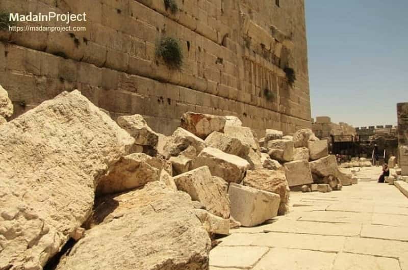
70 CE Rubble
The large stones which had been knocked down from the western retaining wall of the Temple Mount in 70 CE, destroying the shops and damaging the pavement (inspect). Among the hundreds of stones weighing several tons each, architectural fragments were found which make it possible to reconstruct the staircase of Robinson's Arch and the upper part of the Temple Mount retaining wall. The great piles of fallen stones provide dramatic evidence of the destruction wrought by the Roman legions in Jerusalem in the year 70 CE., which Josephus Flavius described in great detail.
circa 10 CE

Upper City Access Road
The remains of the stairs at the southwest corner of the Temple Mount (looking west) toward the Western Hill (Western Ridge) where the Upper City was located in the first century CE. The Roman bakery (partially visible as burnt ashlar) and the base of Robinson's Arch is to the right


Signup for our monthly newsletter / online magazine.
No spam, we promise.
The Madain Project is an online archive of Abrahamic History and Archaeology.
Abrahamic History & Archaeology is the study of history and archaeology with respect to the three Abrahamic Faiths without considering the religious and theological aspects. The goal of Abrahamic History is to understand how and why the religious doctrines and behaviours have evlovled and changed over time. Searching for patterns in the evolution of significant cultural events such as the development of farming, the emergence of cities, or the collapse of major civilizations for clues of why and how these have influenced the three major Abrahamic religions.
Cloud Drive -
About -
Help -
Editorial Policy -
AI Policy -
Privacy Policy -
Contact
Madain Project: Encyclopedia of Abrahamic History & Archaeology.
Copyright MadainProject 2017 - 2026.
![]()
![]()
![]()
![]()
![]()
![]()