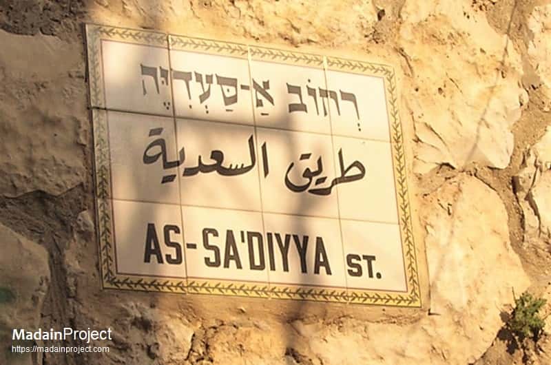
as-Saadia street, also spelled as al-Sa'diyya ascent (طريق السعدية), is a narrow street inside the walled or old city of Jerusalem close to the Damascus Gate. Situated in the Muslim Quarter of al-Quds it runs parallel to the northern wall of the Jerusalem and the al-Mawlaviyya street in the south.
The street a notable thorougfare in the Haárat Sa'diyya (حارة السعدية) neighbourhood, lies approx. 110 meters south-east of the Damascus Gate (Bab al-'Amud) and approx. 90 meters south-west of the Harod's Gate in Jerusalem. It starts from the Ibn Jarah street in the west and runs eastward for a length of approx. 150 meters and merges in to the Hatsariah HaAdom street.
al-Sa‘diya street is a historic and narrow street located in the Muslim Quarter of the Old City of Jerusalem, Palestine. It takes its name from the Bani Sa‘ad (Saadis), a Palestinian family that settled here after accompanying Salah al-Din Ayyubi (Saladin) during the 12th-century CE reconquest of the historic city. The street winds past ancient mosques, saints’ shrines, and traditional homes, serving as a living testament to the local Palestinian heritage. This alley reflects centuries of community life, faith, and resistance amid occupation and urban change.
circa
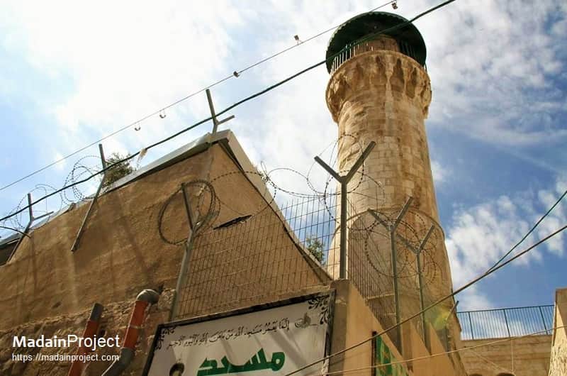
The Red Minaret Mosque
al-Madhana al-Hamra (المئذنة الحمراء) is one of the first Ottoman monuments in the city of Jerusalem, built circa 1533 CE (940 Hj.). It is named after the minaret, which was built with red stone. It built of stone in red and white (the precious stone) and has a gate in its wall north. The southern wall of the small mosque, which measures 9x4 square meters only, hosts a beautiful mihrab.
Signup for our monthly newsletter / online magazine.
No spam, we promise.
The Madain Project is an online archive of Abrahamic History and Archaeology.
Abrahamic History & Archaeology is the study of history and archaeology with respect to the three Abrahamic Faiths without considering the religious and theological aspects. The goal of Abrahamic History is to understand how and why the religious doctrines and behaviours have evlovled and changed over time. Searching for patterns in the evolution of significant cultural events such as the development of farming, the emergence of cities, or the collapse of major civilizations for clues of why and how these have influenced the three major Abrahamic religions.
Cloud Drive -
About -
Help -
Editorial Policy -
AI Policy -
Privacy Policy -
Contact
Madain Project: Encyclopedia of Abrahamic History & Archaeology.
Copyright MadainProject 2017 - 2026.
![]()
![]()
![]()
![]()
![]()
![]()