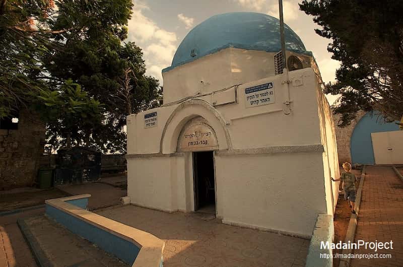
The Tomb of Benjamin also known as Maqam Bin Yamin (قبر النبي يامين) is the traditional burial site of Benjamin according to Islam, but some Jews believe that this is the tomb of Benjamin and converted the Maqam (Muslim shrine) into a synagogue, in the other side of the bypass road there is also another Islamic shrine called "Nabi Sawarka".
Benjamin was the youngest son of the Biblical patriarch Jacob and the Biblical matriarch Rachel. His tomb, called Kever Binyamin in Hebrew, is covered by a small building with a domed roof. This burial place was originally marked by a Muslim Mamluk ruler named Tankiz. An image of a goblet (inspect) appears above the entrance to the tomb, recalling the famous story of how Benjamin’s brother Joseph, acting as the viceroy of Egypt, hid a goblet in Benjamin’s luggage in order to frame him for espionage.
circa 1730 CE

Account of al-Luqaymi
In 1730, the Egyptian Sufi traveller al-Luqaymi who visited Kafr Saba mentined the shrine for a local religious figure, Binyamin (also called al-Nabi Yamin). In 1808 CE, the riwaq (prayer hall) was constructed, according to a now vanished inscription. This riwaq occupies the south side of the main enclosure of the shrine. By the end 1948 only the two shrines, the school, and the ruins of the village cemetery remained. The shrines have arched entrances and are surmounted with domes.
circa 1874 CE

The Clermontt Account
Clermontt mentions that near Muluk Saba (ancient name of Kafr Saba) stand two snactuaries side by side, one is the tomb of Nabi Benjamin (which unilt that time was assigned by Jewish tradition to Ruma to the north of Sepphris) and the other is believed to be the tomb of Nabi Swraka. This location used to be located on the main road from North (Galilee, Syria and beyond) and south (Egypt). The next stop south was Jaljulia, the Gilgal of the Sharon.
circa 1300 CE
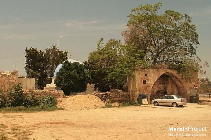
The Tomb, and some of the ruins around it, are from the Mameluke period (14th century CE). A Khan nearby has the stone plate with the date of 1312. The sebil (public water fountain) in front of the tomb was built on the side of the Mamluke “Postal” road from Cairo to Damascus. This road was initiated by the first Mameluke emperor, Baybars, in 1268. It served the Mameluke empire until the 16th century CE. An inscription embedded on the right side of this sabil referred to the foundation of a fountain for the public by Emir Tankiz, governor of Damascus in 1311-1312 CE.


Signup for our monthly newsletter / online magazine.
No spam, we promise.
The Madain Project is an online archive of Abrahamic History and Archaeology.
Abrahamic History & Archaeology is the study of history and archaeology with respect to the three Abrahamic Faiths without considering the religious and theological aspects. The goal of Abrahamic History is to understand how and why the religious doctrines and behaviours have evlovled and changed over time. Searching for patterns in the evolution of significant cultural events such as the development of farming, the emergence of cities, or the collapse of major civilizations for clues of why and how these have influenced the three major Abrahamic religions.
About -
Help -
Privacy Policy -
Contact
Madain Project: Encyclopedia of Abrahamic History & Archaeology. Copyright 2017 - 2024.
![]()
![]()
![]()
![]()
![]()
![]()